The Amazon Rainforest, formerly connected by rivers, is now giving way to the Rainforest connected by roads. Let’s reflect on the pace and significance of the momentous change of these landscapes.
Author: Gabriel Costa
Auf Deutsch lesen. Leia em Português.
::
The Two Amazon Rainforests: Two Ways to Travel in the Region, by Boat or by Bus
The Amazon Rainforest is the largest tropical forest in the world with the greatest biodiversity, covering approximately 50% of Brazilian territory. But you probably already know this. What goes unnoticed in most of the editorials of the major newspapers, in the media in general and in the public imagination is the following: the Brazilian Amazon Rainforest is home to 23 million people, a home to a population similar to that of Australia, with a multiplicity of religions, ethnicities, dialects, world views, and contrasts.
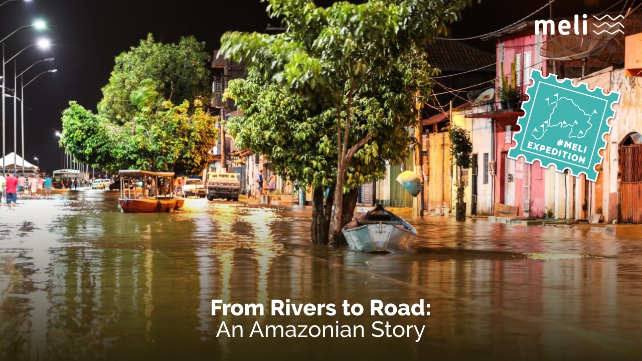
One of the most striking contrasts is that between the “Amazon Rainforest of the Rivers” and the “Amazon Rainforest of the Roads”. This contrast permeates my experiences, the Amazonian accustomed to long journeys, who writes this text directly from the intersection between these two worlds, Belém do Pará. If in Western Europe, all roads lead to Rome, here most roads lead to Belém.
::
The Dance of the Waters: This River is my Street
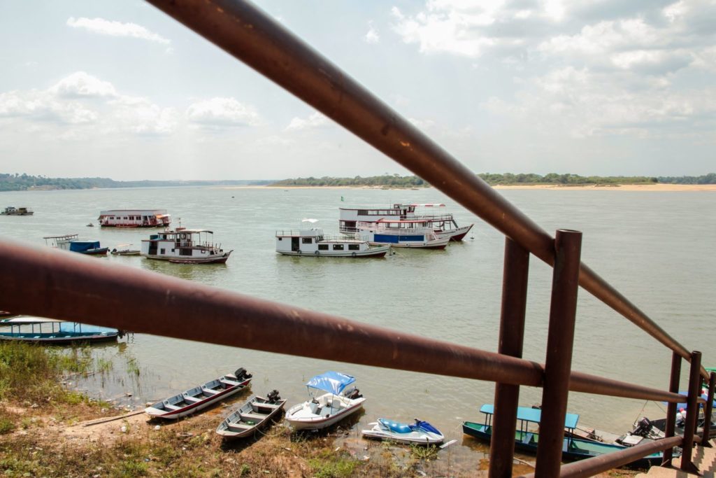
However, what would each of these divisions be like? The “Amazon Rainforest of the Rivers” would be the part of the region where the transport on the river and its logic still prevail. The rivers regulate the rhythm of life, slower and cyclical, based on the annual floods and ebb tides. The flow of the waters feeds the population and orders the organisation of the cities, especially the older ones, with their streets facing the ports and markets concentrated on the banks of the large bodies of water.
The rivers regulate the rhythm of life, slower and cyclical, based on the annual floods and ebb tides.
This typically Amazonian architecture can be observed in the heart of Belém, home to the largest open-air markt in Latin America, the Ver-o-Peso, with its rock of salt and fish, which makes way for a dense, meandering and noisy commercial area – the homonymous trade district – where, according to legend, you can buy everything. Or in Mocajuba, on the upper Tocantins River, a city with great influence from the remnants of quilombos, which has in its centre, on the banks of the river, a large fish market and large platforms where you can feed the Tucuxi dolphins, the joy of tourists.

Even further north, in the Marajó region, in its largest cities, Breves, Portel and Soure, it is not unusual for the flow of goods and people to be regulated by the large iron boats that make the crossing between the archipelago and the state capital in their daily round trip. The very identity of the towns is often linked to their riverside vocation, for example in Vigia, the oldest “European” city in the federal state, where the municipal symbol is the “Vigilenga” a sturdy boat that allows fishing in the open sea.
::
The Other Side of the Mirror: The Amazon Rainforest of Roads
However, it’s not all flowers, or rather all rivers in these tropical lands. From the 1950s onwards, the Brazilian government adopted a series of policies aimed at the “integration” and colonization of the “wild lands” of Brazil. Part of this strategy was the construction of the new Federal Capital and its great highway, the BR 010, or Transbrasilian Highway, or just: Belém-Brasília. Under the auspices of the then President Juscelino Kubitschek, the “Amazon Rainforest of Roads” had begun, symbolised by the road that would “break through the jungle and unite the country from north to south.”
However, it’s not all flowers, or rather all rivers in these tropical lands.
The road was started on two fronts: one from Belém, led by physician Waldir Bouhid, and the other from Brasilia, led by agricultural engineer Bernardo Sayão who, in the words of the author Leonencio Nossa, was crushed to death by a Jatobá tree which buried his tent, in a “revenge of the forest”, near Açailândia, in Maranhão, the gateway to the unique region of the Maranhão Amazon. The neighbourhood has already been thematized on our blog in a previous text.
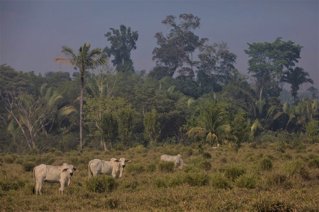
Today, the Belém-Brasília highway is one of the most important routes for transporting cargo in the country. But along it, trees are rare, well, at least native ones. In the “Amazon Rainforest of Roads”, located especially along the aforementioned road as well as its “sister in tragedies” — the Transamazonian Highway — and other roads in the Southeast of the state of Pará, the logic that reigns is that of road transport. Life is built on the production of commodities in an accelerated linear everyday life. The river was replaced by asphalt or gravel where the new towns, fed by migrants from the Northeast, grew up. The “green flags”, a reference to a “promised land” as described in an excerpt from the famous prophecy of the Northeasterner Padre Cicero that motivated migratory waves to the Amazon during the 19th and 20th centuries, are no longer that attractive or that free.
Life is built on the production of commodities in an accelerated linear everyday life.
::
:The Journey: A Tour de Force through Amazonian Desolation
These questions have always occupied my mind when faced with the monotony of the long 12-hour drive across the Belém-Brasília highway separating Marabá, my hometown, from the capital — one of the potential paths for those who wish to make this journey. My city, Marabá, was the initial stage of this transformation from river to road. The old city, founded at the beginning of the 20th century, preserves its riverside pattern, facing the Tocantins River. The newer districts face the Transamazon.
Leaving from there by bus, still on the PA 222, we pass through some towns: Bom Jesus do Tocantins, home to the last great fragment of native forest until close to Belém, the Indigenous Territory of Mãe Maria, one of the last bastions of a not-so-distant past. However, the tour is short-lived. Soon we reach little “Abel Figueredo” and then “Rondon do Pará”. The sands, oxen, and soy silos dominate the landscape until they give way to the immense green desert of the eucalyptus of “Dom Elizeu”. Congrats, we arrived on the BR 010.
The sands, oxen, and soy silos dominate the landscape until they give way to the immense green desert of the eucalyptus of “Dom Elizeu”.
On its banks, except for the patches of forest and the scorching heat, there is little that resembles the Amazon Rainforest of Rivers. The landscape is rural and urban, as if in a string of beads, small villages follow each other until we reach Ulianópolis and its branch line to the PA 125, which runs parallel to our route, reaching the Capital of agribusiness and mining, Paragominas. Formed by the junction of the ancestry of its founders, Pará, Goiás and Minas, the city was once the largest deforester of Pará and today is considered a “leader in green policies” such as incentives for reforestation, land title regularization through CAR (Rural Environmental Registry) and reduction of illegal deforestation, although there is not so much “green” there.
Afterwards, already exhausted by the bumpy ride and existential despair — summed up in the thought “Was all this once a forest?” — we reach Ipixuna do Pará, Aurora do Pará and finally Mãe do Rio. This town is crossed by the Igarapé homonymous, a tributary of the mighty river Guamá. Here the realms begin to change, and we will have a transition zone between the two worlds — the river and the road — which will continue to the capital.
“Was all this once a forest?”
In another hour’s drive we reach São Miguel do Guamá, the municipality where the mighty river flows into Guajará Bay, bathing the Ver-o-Peso, from where we began. The links start fitting together as we pass through Santa Maria do Pará, Castanhal (a city that is a real road hub), Santa Izabel and Benevides, already in the metropolitan region of Belém.
::
The Arrival
The landscape until we reach Ananindeua, a city that is close to Belém and finally some rest, alternates the green of the riverside, where cable-stayed bridges run, and the grey of the urban landscape, with less oxen and more people. In the end, we arrive.
Whenever I set foot in Belém, much of what I write here crosses my mind, but the saddest sight is that the Amazon Rainforest of the Roads grows even larger, while the river recedes. Fed by predatory agribusiness and new-old integration projects, entire regions of the Amazon Rainforest are going through the same process as my hometown, and depending on the situation we are in, we will have more stories like this one.
Your donation can have a positive impact on the world!
Subscribe to receive our Newsletter!
Find us also at Linkedin, Facebook, Twitter or Instagram
www.meli-bees.org
❤️
Title Image: Nubia Suriane, edition by Ícaro Uther
References:
(1) Memorial da Democracia: Belém-Brasília une País De Norte a Sul. In: http://memorialdademocracia.com.br/card/belem-brasilia-rodovia-de-integracao
(2) Mata!: o Major Curió e as guerrilhas no Araguaia / Leonencio Nossa. — 1a ed. — São Paulo: Companhia das Letras, 2012.
2 Replies to “From River to Roads: An Amazonian Story ”